Monday, March 5, 2012

Palakkad Fort


http://commons.wikimedia.org/wiki/File:Palakkad-Fort-outside-view.JPG

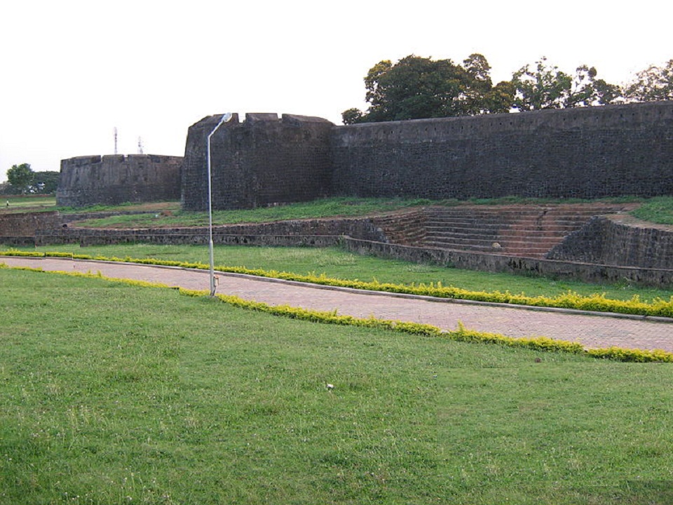
Fort dating from 1766, built by Hyder Ali of Mysore. In 1784, after a siege which lasted eleven days, the British Colonel Fullerton stormed the Fort. Later it fell into the hands of the Zamorin’s troops, but was recaptured by the British in 1790. This well-preserved fort is also known as Tipu's (Tipu Sultan, son of Hyder Ali) Fort.


There is a large ground between the Fort and the Palakkad Town hall, known as Kota Maidanam (Fort Grounds). The ground, which had once served as a stable for the elephants and horses of Tipu's army, is now used to stage cricket matches, exhibitions and public meetings. An open air auditorium called "Rappadi", currently under the preservation of the Archaeological Survey of India, is also located within the spacious grounds of the Fort. Additionally, there is a children's park on one side of the Fort.

There is a small Anjaneya (Lord Hanuman) temple inside the fort that attracts a number of devotees.
One of the rare picture by the uploader


http://commons.wikimedia.org/wiki/File:Palakkad_Fort-temple-inside.JPG

http://commons.wikimedia.org/wiki/File:Palakkad-Fort-inside-view22.JPG

The Palakkad Sub Jail is also located within the fort.And civil supplies office also functions inside
It is said that Hyder Ali had plan to build the famous Palakkad Fort here, before it is built in its present location. Granites and rocks are kept here for constructing the fort. But the plan was changed and the fort was constructed at Palakkad. The resulted massive plain land was used by the people of nearby villages as a market of ancient times. Since then this area is known as 'Kottachantha' of which 'Kotta' means Fort and 'Chantha' means Market in malayalam language


It is believed that the name of the next village Kottayi, is derived from the use 'Kottayilekkulla Vazhi/Vayi' meaning 'The way to Fort' which also strongly support Hyder Ali's plan to build the fort here. However, there are no disputes over the arguments on Kottachantha's historical importance connected to Palakkad Fort.


References:http://en.wikipedia.org/wiki/Palakkad_Fort
http://commons.wikimedia.org/wiki/Category:Palakkad_Fort

PALAKKAD


http://en.wikipedia.org/wiki/File:Palakkad_Fort.JPG

At First i would like to give you a brief description of Palakkad ,the beautiful place to live as many others it mine too,i born and bought up over here in the lap of Palakkad, Palakkad District (Malayalam: പാലക്കാട്),previously known as Palghat, lies near the Palghat Gap, a pass or natural depression through the Western Ghats ranges, and connects Kerala to the plains of the state of Tamil Nadu to the east


Is one of the 14 districts of the Indian state of Kerala. The city of Palakkad is the district headquarters. Palakkad is bordered on the northwest by the Malappuram District, on the southwest by the Thrissur District and on the east by Coimbatore district of Tamil Nadu. The district is 13.62% urbanized. The district is nicknamed "the granary of Kerala".


In earlier times Palakkad was also known as Palakkattuchery. Some etymologists trace the word "Palakkad" from the word Palai nilam, which means "dry lands". The commonly held belief, however, is that the name is a fusion of two Malayalam/Tamil words, Pala, a tree that is found abundantly in Palakkad, and Kadu, which means forest.


Is a large town and muncipality in the state of Kerala in southern India, spread over an area of 26.60 km2 and is the administrative headquarters of the Palakkad District. Palakkad is the seventh most populous city in Kerala and. The city is situated about 350 kilometers  north of state capital Thiruvananthapuram and 49 kilometers  south west of Coimbatore.

Kerala would have an IIT in Palakkad under the 12th five-year plan. The land belonging to the Instrumentation Limited in Palakkad was finally chosen for the project.


Tourist Places
Malampuzha Dam and Garden, Palakkad Fort, Nelliyampathy, Silent Valley National Park, Parambikulam Wildlife Sanctuary.

Local Bodies

Taluks: Palakkad, Mannarkkad, Ottapalam, Alathur, Chittur
Blocks: Alathur, Attappadi, Chittur, Kollengode, Kuzhalmannam, Mannarkkad, Malampuzha,                Nemmara, Ottappalam, Palakkad, Pattambi, Sreekrishnapuram, Thrithala
Municipality: Palakkad, Shornur, Chittur-Tathamangalam, Ottapalam
Constituencies
Parliament: Palakkad, Ottapalam, Alathur
Assembly: Thrithala, Pattambi, Shornur, Ottapalam, Kongad, Mannarkkad, Malampuzha, Palakkad, Tharoor, Chittur, Nemmara, Alathur
Rivers
Bharathappuzha, Gayathri, Kalpathi, Kannadippuzha, Thutha, Bhavani


Air
The nearest international airport is Coimbatore Airport, which is around 55 km from Palakkad.  Other nearby airports are Kozhikode Airport about 103 km & Kochi Airport which is about 111 km from Palakkad.There has been a proposal for a mini domestic airport near the city at East Yakkara with respect to setting up domestic airports for enhanced air connectivity by the civil aviation ministry of India. 60 acres has been identified for the project at East Yakkara.


Railways
There are two railway stations serving Palakkad - Palakkad Junction is a broad gauge railway junction (located at Olavakkode) and Palakkad Town located in the heart of the Palakkad town. 


Road
Palakkad is well connected by roads. The National Highway  from Salem to Kochi and the Palakkad – Kozhikode National Highway pass through the district. Another important road is the Palakkad – Ponnani which connects NH 47 and NH 17.Apart from the National Highways, Palakkad is well connected through State Highways to nearby districts and towns in Kerala.


Reference:     http://en.wikipedia.org/wiki/Palakkad#Etymology